
Diving in Apo Island
Turtles at snorkel depth and hard drifts on the points, off a volcanic island whose community closed its own reef in 1982.
Last updated October 2026
Overview
In 1982 the fishing families on this island drew a line around 450 metres of their own shoreline, ran it 500 metres out from the beach, and stopped fishing inside it. Nobody made them do it, and years of talks with biologists and a social worker came first. On 9 August 1994 Presidential Proclamation No. 438 made the whole island and its waters a Protected Landscape and Seascape of 691.45 hectares1, and a Protected Area Management Board now governs it. Angel Alcala, who ran the Silliman marine laboratory in Dumaguete and later served as environment secretary, drove the reserve. He died in February 2023.
Monitoring started in 1983 and has run near-annually since, which is the rare part. Predatory fish biomass was still climbing exponentially after 18 years2, and 26 years of data put a new steady state 20 to 40 years out3. Targeted fish went from 25 tonnes per square kilometre in 1982 to 125 tonnes 26 years later4.
The coral is the part that has changed, so every figure carries a year. The sanctuary held up to 75 percent live hard coral before December 20125. Tropical storm Sendong in late 2011 and typhoon Pablo in December 2012 battered it6. Surveys in March 2013 recorded 99 percent coral damage and reef fish down by about half7, while a reef check that July found the northern reefs untouched, so the damage was never island-wide8. Live hard coral fell to under 1 percent, with fish four to five times below a 2008 baseline5. The damage reached the reef's deepest limit at 40 metres, leaving no deep refuge9. Rehabilitation ran from 2013 to 2016, and some divers in December 2024 still called the coral damaged.
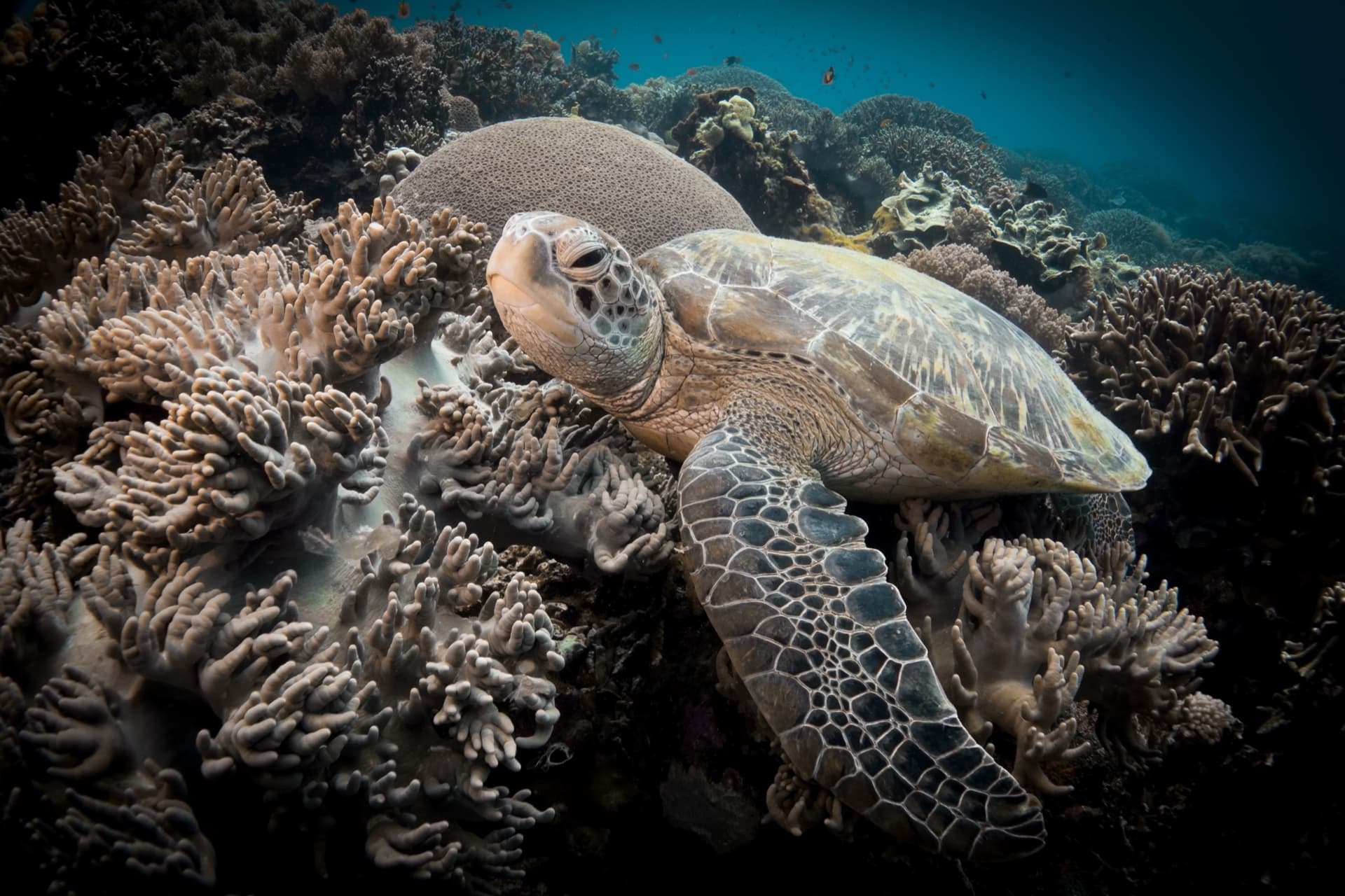
None of that is a reason to skip it. Green and hawksbill turtles feed on the shallow seagrass off the village and are why hundreds of day visitors come. The diving proper is about water movement. Coconut Point on the north coast has been measured at 1 to 2 knots over a steep slope, with whitetip reef sharks on the sand around 28 metres. Mamsa Point is named for the local word for jacks, which hold where a gentle slope steepens abruptly. Chapel drops from a ledge at 12 metres into a wall of sponges, sea fans and whip corals. Largahan is the odd one, geothermal gas bubbling through dark volcanic sand in 6 to 14 metres, with frogfish and nudibranchs around it.
Planning your visit
Apo is dived as a day trip from Dauin or Dumaguete, by outrigger banca from the centre's own beach, 30 to 45 minutes across, with up to three dives and surface intervals ashore. The dive team picks the sites that morning from conditions and group ability, so say which site you hope for when you enquire and treat the answer as provisional. Operators tend to keep Open Water divers on the sanctuary, Katipanan and Largahan and offer the points to divers who have logged moving water. Staying on the island is possible, but electricity and fresh water have been limited, and Dauin adds the black sand macro diving Apo does not.
The island charges an entrance fee at different rates for Filipino and foreign visitors, paid in cash at the beach office, plus a per-group guide for the sanctuary snorkel area. Amounts shift, so ask your centre what the day already covers. The sanctuary itself has been closed for rehabilitation before, and one diver in July 2025 found it officially shut yet in use. Touching, chasing, feeding or blocking the path of marine life is not allowed, sea turtles are protected under Philippine wildlife law, and every arriving visitor gets a briefing. Over storm rubble and rehabilitation structures, buoyancy matters more than usual5.
The settled season is November to May, and the habagat from June to September can cancel crossings; in July 2025 the coast guard stopped boats leaving the island for several days. Leave a spare day in the itinerary. Water sits at 27 to 29 C and a 3 mm suit is enough. On the points, carry an SMB and reel, because current can separate a diver from the boat.
Geology & underwater terrain
A hilly volcanic island in the Bohol Sea, ringed by a narrow fringing reef that bottoms out near 40 metres. Geothermal gas still rises through dark volcanic sand at Largahan.
Dive sites in Apo Island
The diving here splits into 3 zones:
- The northern and eastern points
- — Coconut Point on the north coast, Mamsa Point and Cogon on the east: the drift dives, offered when the group can handle them and the swell allows.
- The southern shore and the sanctuary
- — The no-take zone off the main village, with Katipanan beside it: shallow, sheltered and close to calm, and the ground the turtles share with the snorkellers.
- The southern tip and the west coast
- — A sharp southern point splits Rock Point into an east and a west dive, both exposed. Round the corner sit Chapel's wall and the gas vents at Largahan.
Marine life
When to dive
- Best season
- November to May
- Water temperature
- 27 to 29 C, diveable year-round
The amihan, the northeast monsoon, brings calmer seas and better water from about November to May, with March to June named as the visibility peak. In the habagat, from June to September, rain, swell and visibility near 10 metres can cancel the crossing, and north-facing Coconut Point becomes unusable.
Safety considerations
What can go wrong here, and what divers do about it. Conditions change - take the briefing from the operator on the day.
- Current: Coconut Point has a reputation for strong down currents and has been measured at 1 to 2 knots, multi-directional; one July 2025 dive there was a very mild drift. Mamsa Point and Cogon also run, and the points intensify around the full moon.Carry an SMB and reel, stay with the guide, and let the guide pick the site for the group.
- Surface and boat traffic: Crossings are cancelled in swell. During the July 2025 habagat the coast guard barred all boats from leaving Apo for several days.Build a spare day into a Dauin itinerary and sleep on the mainland if the schedule is fixed.
- Marine life: Storm rubble and rehabilitation structures lie in the sanctuary shallows.Hover, do not settle; secure gauges and camera.
Rules and permits
National rules also apply: Rules and permits in Philippines
Frequently Asked Questions
When did the storms hit Apo Island, and was it Typhoon Yolanda?▾
The peer-reviewed survey and the reports of the July 2013 reef check name tropical storm Sendong in late 2011 and typhoon Pablo in December 2012. One conservation group's May 2013 post gives the years as 2012 and 2013, and a diver's 2025 account blames Yolanda. Yolanda made landfall in November 2013, after the March 2013 surveys that recorded 99 percent coral damage and after the July 2013 reef check, and it tracked through the Eastern Visayas, far from Negros Oriental. The damage predates it.
What is the coral at Apo Island actually like now?▾
Damaged, but not everywhere. The sanctuary held up to 75 percent live hard coral before December 2012. Surveys in March 2013 recorded 99 percent coral damage there and about half the reef fish, and live hard coral later fell to under 1 percent with fish four to five times below a 2008 baseline. Reefs on the northern side were reported unaffected in 2013. Rehabilitation ran from 2013 to 2016, ending with limestone fish habitats in March 2016. Nothing newer has been published, and some divers in December 2024 still described the coral as damaged.
Can you dive the Marine Sanctuary itself?▾
Access varies with the week you book. An operator warns that access may be restricted depending on local regulations, and the zone has been closed for rehabilitation before. One diver in July 2025 was told it had been closed for years, yet dived it twice and saw snorkellers there. When it is accessible it is the easiest water on the island, shallow, guided and close to calm. When it is not, the rest of the island still works.
How strong are the currents, and which sites suit a newer diver?▾
The island divides cleanly. Coconut Point, Mamsa Point and Cogon are the moving-water dives, and Coconut faces north so swell can rule it out. Rock Point East and West sit on an exposed corner. Chapel is two dives in one, easy on the shoulder above the 12 metre ledge and advanced on the wall below. The sanctuary, Katipanan and Largahan are shallow with little or no current. Operators tend to match the site to the group on the morning.
Is Rock Point East a beginner dive?▾
Not safely assumed. One widely read guide calls it one of the island's most beginner-friendly sites with gentle currents. Three other accounts describe regular current on an exposed point, and one rates it intermediate to advanced down to 35 metres. Treat it as a point dive and let the guide who has seen you in the water decide.
How does a day trip to Apo Island from Dauin work?▾
You book the day through a Dauin or Dumaguete centre and leave from its beach in an outrigger banca. The crossing is 30 to 45 minutes from Dauin and about 45 from the public pier at Malatapay. A normal day is up to three dives with surface intervals ashore, lunch usually included, and an optional walk to the lighthouse. You register and pay island fees in cash on arrival. The dive team chooses the sites on the morning from conditions and group ability, so Coconut Point is something you may be offered, never something you order.
Should I stay on Apo Island or day trip from the mainland?▾
Almost everybody day trips. The island is a small community with limited fresh water, a small pharmacy and no 24 hour electricity as recently as 2022, and the crossing can be stopped by weather. Homestays and small lodges exist. Dauin is closer, cheaper and runs more often than Siquijor, and it gives black sand macro that Apo does not, so the two do different jobs.
Did the reserve actually work?▾
It is one of the few places with a measured answer, because monitoring has run near-annually since 1983. Predatory fish biomass was still rising exponentially after 18 years, and 26 years of data suggest 20 to 40 years of protection before a new steady state. Targeted fish biomass went from 25 tonnes per square kilometre in 1982 to 125 tonnes 26 years later. The lesson usually drawn from Apo is the timescale: decades, not years.
Also known as: APILAS, Isla Apo
References
- 1.Malacañan Palace, August 9, 1994 — Proclamation No. 438, s. 1994
- 2.Oecologia 138(4): 622-627 — Marine reserves: long-term protection is required for full recovery of predatory fish populations
- 3.Oecologia 163(4): 1103-1106 — Decadal-scale rebuilding of predator biomass in Philippine marine reserves
- 4.Transactions of the National Academy of Science and Technology PHL 39(2) — Apo Island and Sumilon Island Marine Reserves and Beyond
- 5.Coastal Conservation and Education Foundation, March 16, 2016 — Continuing our Coral Reef Recovery efforts in Typhoon-Damaged Reefs
- 6.The Freeman / Philstar, July 10, 2013 — Reef check in Apo Island: Greenpeace probes coral damage
- 7.Coastal Conservation and Education Foundation, May 23, 2013 — Apo Island Marine Sanctuary: Steps to Recovery from Storm Damage
- 8.Greenpeace Philippines — Hope amid devastation in one of the world's best marine sanctuaries
- 9.Coral Reefs 37(1): 81-97 — Benthic habitat and fish assemblage structure from shallow to mesophotic depths in a storm-impacted marine protected area
Every dive has a story. Share yours.
Log your dives - notes, photos, conditions and the marine life you saw - and share them as one public diver profile. What you share helps the next diver, too.
Log every detail
Depth, duration, conditions, gear, buddy, notes — all in one place. Import from Suunto and other dive computers.
Track marine life
Record species sightings on each dive. Build a personal catalogue of everything you've seen underwater.
Your public dive profile
Share your dive history, stats, and experiences with a profile page you control. Show the world where you've been.