
YellowSub Tarifa
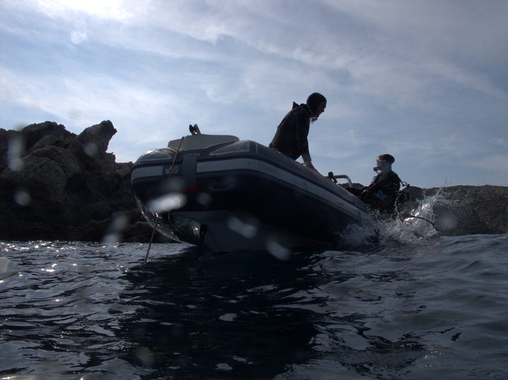
Family-run PADI 5-Star Dive Resort in Tarifa harbour, the Parque Natural del Estrecho information point, with short boat dives around Isla de las Palomas.
PADI4 services3 languages
An island at continental Europe's southern tip where the Atlantic meets the Mediterranean: walls, wrecks, a kelp forest, and strong tidal currents.
Last updated May 2026
Almost all the diving is around one island. Isla de Tarifa, barely 500 metres across, is the southernmost point of continental Europe and a boundary: the eastern face opens to the Mediterranean, the western to the Atlantic, and the two water masses mix around the point. Dive sites ring it, five to ten minutes from the harbour. Mediterranean and eastern-Atlantic species overlap, over 1,900 marine species have been recorded here, and a temperate kelp forest grows on the east face that has no business being this far south.
Each face dives differently. La Garita on the sheltered north is the shallow beginner site, with macro life and ancient anchor stones in the sand. The east face has La Piscina, an easy boulder garden, and Las Laminarias, the slack-tide kelp forest at 22 to 25 metres. Punta Marroqui at the southern point is the headline advanced dive, a 300-metre Mediterranean cliff with Roman amphorae near 40 metres on one face, a gorgonian Atlantic reef on the other. Off the same toe lies the signature wreck, a 19th-century paddle steamer at 28 to 40 metres with boilers, paddle wheels and resident conger eels. The Atlantic-facing west is Las Calles, a block labyrinth with the naturally lit Cueva del Viento cavern. Groupers are around but wary; turtles, sunfish and eagle rays are summer chances.
Tarifa is a planning exercise, and the thing being planned is the tide. The exchange between the two seas can run to about 4 knots at peak coefficients and does not reliably follow the tables, so the centres pick the day's sites and dive times from the tide and the wind, often the morning of. Slack water is essential for the kelp forest, the southern point and the deep wrecks; the sheltered north face stays diveable on most levante days. Confirm the plan before you set out. Independent diving is not possible. The island sits in the Parque Natural del Estrecho, where diving needs an authorisation the centre handles, with no diver quotas or reserve fees beyond the Spain-wide federation licence, around 7 EUR. Best season is May to October; August is crowded and parking is hard in the kitesurfing peak. Dress colder than the latitude suggests, since continuous cool Atlantic flow holds bottom temperatures around 15 to 20 degrees year-round, so a 7mm with a hood and gloves is the summer minimum. Carry a torch and an SMB.
The island rises from the seabed between 6 and 50m, set in Quaternary sandy-marly flysch with characteristic abrasion platforms along the coast. Each face has its own character: a sheltered talus slope on the north, block-chaos and natural pools on the east, vertical cliffs with overhangs at the southern point, and corridors of eroded blocks on the Atlantic-facing west.
The must-do dives in this area, picked by our editors.
AOW divers wanting Tarifa's two-faces-in-one-day dive at Europe's southern tip
Advanced divers who plan around the tide and want a 19th-century paddle steamer with structural relief and resident conger eels
AOW divers comfortable with slack-tide discipline who want the only easy-reach kelp forest in southern Spain
Divers after a slow Tarifa dive through orange-coral corridors and a naturally lit cavern, on calm or slack-tide days
New and returning divers wanting an easy Tarifa boulder dive with macro critter life and a shallow platform for skills work
Diamonds mark nearby dive areas — tap to explore.
Sheltered shallow dive on the north face of Isla de Tarifa: the area's beginner and try-dive site, with macro life and anchor stones on rock and sand.
Boulder-chaos dive on the east face of Isla de Tarifa: sandy pool-like clearings at 4 to 8m for training, dense moray and nudibranch life down to about 25m.
Andalucia's most accessible kelp-forest dive: Laminaria ochroleuca fronds up to 4m on the east face of Isla de Tarifa, slack-tide only, from about 22m.
Labyrinth of eroded blocks and sandy alleys on the Atlantic face of Isla de Tarifa, walls sheeted in orange cup coral, with the Cueva del Viento cavern.
Paddle-steamer wreck off the Mediterranean toe of Isla de Tarifa, 28 to 40m of iron machinery and a debris field where conger eels hold home caves.
Continental Europe's southernmost dive. One point, two faces: Levante's deep Mediterranean wall with Roman amphorae, Poniente's gorgonian Atlantic reef.
Book online or contact a centre that dives this area.
Family-run PADI 5-Star Dive Resort in Tarifa harbour, the Parque Natural del Estrecho information point, with short boat dives around Isla de las Palomas.
SSI Instructor Training Center in Tarifa with a marine research laboratory, technical diving with CCR and sidemount, and 10 sites around Isla de las Palomas.
SSI Diamond Center in Tarifa with BAUER PURE AIR fills and SCR rebreather courses. Four consecutive Diamond years. Only center in Tarifa with either distinction.
Get in touch to add or claim your dive center listing on DiveCodex.
Log your dives - notes, photos, conditions and the marine life you saw - and share them as one public diver profile. What you share helps the next diver, too.
Log every detail
Depth, duration, conditions, gear, buddy, notes — all in one place. Import from Suunto and other dive computers.
Track marine life
Record species sightings on each dive. Build a personal catalogue of everything you've seen underwater.
Your public dive profile
Share your dive history, stats, and experiences with a profile page you control. Show the world where you've been.