YellowSub Tarifa
Family-run PADI 5-Star Dive Resort in Tarifa harbour, the Parque Natural del Estrecho information point, with short boat dives around Isla de las Palomas.
PADI4 services3 languages
Also known as: Punta Maroquí
Continental Europe's southernmost dive. One point, two faces: Levante's deep Mediterranean wall with Roman amphorae, Poniente's gorgonian Atlantic reef.
Last updated May 2026
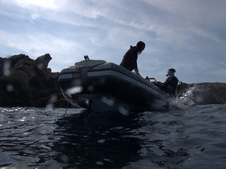
Two faces of one rock, and you dive whichever the wind allows. The boat ride from Tarifa harbour is short and tells you nothing about the point. The centre reads the tide and the wind that morning and picks Levante, the Mediterranean side, or Poniente, the Atlantic. Below the lip you stay on that face, because the current between them rules out a crossing.
Levante is the wall. A fixed line drops you to around 16 metres, you regroup on the shallow plateau, then run a cliff close to 300 metres long. Its overhangs swallow torchlight. Orange cup coral sheets the rock, morays and conger eels work the cracks, and the fish life thickens at depth, where old iron debris and Roman amphorae and millstones rest near 40 metres. This is the most current-exposed face on the point. Slack means a controlled wall dive; mistime it and half the dive is spent flying along at 15 metres while the current does the swimming.
Poniente is the slow one, a sheltered cliff ledge between 8 and 25 metres fed by nutrient-rich ebb currents that grow things. White, red and yellow gorgonians line a shaded wall, a dark cave holds Dendrophyllia ramea coral, and past the ledge the sand slopes to 45 metres with the anchors on it. Admiralty anchors and a Roman anchor stock are the features that gave this face its local name. Both faces close on the 4-metre plateau for the safety stop, with barracuda overhead.
No other Tarifa site hands you two materially different dives off a single promontory. One side is a deep wall with archaeological clutter on the bottom; the other is one of the richest zones of Isla de Tarifa, a gorgonian garden with the anchors that earn it the name inmersión de las anclas. Centres work both under one dive plan and one mooring rotation, so a single boat day buys the geographic hook of continental Europe's southernmost point and two dives that share almost nothing but the plateau between them.
The water runs cold. There is a temperate-Atlantic feel that catches out divers who came for postcard Mediterranean: cup coral on cool rock, conger eels in deep holes, four nudibranch species off one wall on a good dive. The black seabream on the Poniente face run unusually large. Visibility swings hard day to day. Marroquí pays back the diver who learns the slack windows, not the one passing through for a single tank.
The bottom at Marroquí reads as layered time. The amphorae and millstones on the Levante wall, and the anchor stock on the Poniente sand, point to first-century Roman trade through the Strait, one of the choke points for any vessel between the western Mediterranean and the Atlantic. The headland takes its name from Tarif ibn Malik, who launched the Islamic conquest of Hispania from this coast in 711 AD. Isla de las Palomas was joined to the mainland by a causeway in 1808 and held a military installation from the 1930s until 2001, which is much of why the surrounding seabed escaped heavy use through the 20th century. The admiralty anchors at Poniente are most likely later naval debris and not individually dated. All of it is protected archaeology. You look and photograph; you do not touch anything.
Check the day's plan with the centre before you set out, because the tide tables write the schedule and the face can change on the morning. Marroquí is the dive centres lead with when conditions are right and the first they cancel when the wind or the slack is wrong. You cannot dive the island independently; every dive here runs through an authorised centre.
Dress warmer than southern Spain implies. The Atlantic flow holds bottom temperatures near 15 to 17 degrees through peak summer, so a 7mm and hood is the summer floor; a 5mm two-piece is widely reported as too thin, and a drysuit suits the cooler months. Carry an SMB for the drift potential on Levante, plus a compass and computer, and a torch for the Levante overhangs and the Dendrophyllia cave. The deeper lines, to the Roman artefacts near 40 metres or the Poniente sand floor at 45, are deep or technical territory with their own gas plan. If conditions only allow one dive, take it knowing the day can still get scrubbed. Tarifa has good days and less good days, and the divers who get one shot can leave with either.
What makes this dive site stand out.
Levante is a deep Mediterranean wall, Poniente a sheltered Atlantic reef. Centres pick by wind.
Amphorae and millstones rest near 40m on Levante; a Roman anchor stock lies on Poniente's seabed.
Poniente's shaded, current-fed wall is one of the richest zones of Isla de Tarifa.
Sits on the southern tip of Isla de Tarifa, where the Mediterranean meets the Atlantic.
Strong tidal currents drive the day; centres time the dive around the slack window, not the clock.
36.0001°N, 5.6093°W
Book a guided dive at this site.
Family-run PADI 5-Star Dive Resort in Tarifa harbour, the Parque Natural del Estrecho information point, with short boat dives around Isla de las Palomas.
SSI Diamond Center in Tarifa with BAUER PURE AIR fills and SCR rebreather courses. Four consecutive Diamond years. Only center in Tarifa with either distinction.
SSI Instructor Training Center in Tarifa with a marine research laboratory, technical diving with CCR and sidemount, and 10 sites around Isla de las Palomas.
Get in touch to add or claim your dive center listing on DiveCodex.
The difficulty is current, not depth. Slack tide gives a controlled wall or ledge dive; a mistimed window turns Levante into an unplanned drift. Depth to 40 to 45m on the deeper routes compounds it.
Log your dives - notes, photos, conditions and the marine life you saw - and share them as one public diver profile. What you share helps the next diver, too.
Log every detail
Depth, duration, conditions, gear, buddy, notes — all in one place. Import from Suunto and other dive computers.
Track marine life
Record species sightings on each dive. Build a personal catalogue of everything you've seen underwater.
Your public dive profile
Share your dive history, stats, and experiences with a profile page you control. Show the world where you've been.