SuperDive Tossa
Costa Brava's only PADI CDC, 20+ years in Tossa de Mar with the world's sole Mediterranean SeaHorse Expert specialty and 843 five-star reviews.
PADI / SSI9 services5 languages
Offshore precoralligenous pinnacle cluster at 15-32 m southeast of Illa de Tossa, named for its disorienting rock maze and local lobster reputation.
Last updated April 2026
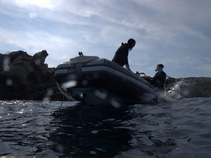
Forty to fifty metres to the left of Illa de Tossa, fifty to sixty metres out to sea. That is how a local diver describes finding Perduts, in landmarks rather than coordinates. The boat drops you at the deep end, around 30 m, where flat precoralligenous rock slabs spread outward over sand. From here you work upward through cracks and canyons between blocks that repeat in every direction. Lobsters occupy the holes. Barracuda schools hang in the gaps. The terrain is the dive. Canyons open to identical-looking formations. Holes lead to more holes. The ascent follows pinnacle tops toward 20 m, where most guides turn the group and begin the return to shallower water.
The Catalan name means "The Lost Ones," and the site earned it. Where Roca Muladera gives you a canyon with defined walls and Mar Menuda gives you thirty routes from one beach, Perduts gives you a rock maze with no signposts. The first visit with a local guide who knows the route is the standard entry path. Older community accounts capture the atmosphere. A diver asks for directions, a Tossa local answers in bearings from a red mark on the island, and the original poster eventually finds the site through a personal contact. The second name, El Pou de la Llagosta, tells a different story. Spiny lobsters colonize the crevices and holes across the formation. In winter, monkfish lie flat against the stone. John Dory appear among the deeper rocks. Spring brings a reported sunfish cleaning station, though divers should treat this as an opportunity rather than an expectation.
Air matters here. The average depth stays above 20 m for most of the dive, compressing non-decompression limits on air. Nitrox extends the window. Local centres cancel Perduts when visibility drops below their threshold. Follow the local rule rather than pushing through. Fishing nets have been documented repeatedly in the Perduts zone, with spring cuttlefish season bringing the heaviest gillnet presence. A cutting tool is not optional. Deploy an SMB on ascent; fishing boats work this area daily. Summer bottom water sits at 16-20 C below the thermocline despite surface temperatures of 24-26 C. Pack a hood and consider 7 mm even in July.
What makes this dive site stand out.
Local name El Pou de la Llagosta (The Lobster Well) reflects decades of spiny lobster association.
Flat precoralligenous formations with cracks and canyons earned the Catalan name The Lost Ones.
Average depth 20 m+ sits below the summer thermocline; bottom water 16-20 C in July-August.
Monkfish and John Dory appear among the deep rocks from December to March.
41.7200°N, 2.9416°E
Book a guided dive at this site.
Costa Brava's only PADI CDC, 20+ years in Tossa de Mar with the world's sole Mediterranean SeaHorse Expert specialty and 843 five-star reviews.
Family-run Costa Brava dive center at Cala Canyelles, Lloret de Mar, with its own boat reaching reefs and pinnacles from Blanes to Tossa de Mar.
Family-run SSI center on Menuda Beach in Tossa de Mar since 1998, with eco-guide philosophy, 17 dive sites, and authorized Cressi service.
Family-feel PADI and CMAS centre in Tossa de Mar with free parking, van to Mar Menuda, and a wide course menu including ice, altitude and DPV specialties.
Get in touch to add or claim your dive center listing on DiveCodex.
Three compounding factors: high average depth below 20 m, disorienting uniform rock terrain, and distance from shore.
Log your dives - notes, photos, conditions and the marine life you saw - and share them as one public diver profile. What you share helps the next diver, too.
Log every detail
Depth, duration, conditions, gear, buddy, notes — all in one place. Import from Suunto and other dive computers.
Track marine life
Record species sightings on each dive. Build a personal catalogue of everything you've seen underwater.
Your public dive profile
Share your dive history, stats, and experiences with a profile page you control. Show the world where you've been.