Anemone Diving Center
PADI, SSI, and CMAS center at Port Marina Palamós with year-round boat dives, small groups, and full MARES equipment. SSI Instructor Training Center.
PADI / SSI / CMAS5 services5 languages
Shallow promontory five minutes from Port Marina with rocky cracks and channels at 6-25 m and the El Cairo fishing-boat wreck at 32-34 m.
Last updated May 2026
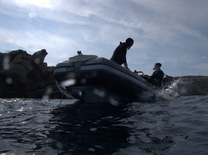
A surface lighthouse marks the shelf and the boat moors above it five minutes out of Port Marina. Drop the line in 6-10 m of water onto the top of the rock, where cracks open into the body of the shelf and damselfish school in the columns of light coming through the slots. Guides drift the upper edge first, working through anemone-lined channels wide enough for a single diver, then descend the seaward face to 18-25 m where cliff sections drop into posidonia meadow at the sand line. The light play is the photographer's reason for the dive: the cliff geometry makes high-contrast scenes routine. From the seabed, AOW divers heading 120° leave the shelf for a short transit across sand to El Cairo at 32-34 m, where the boat structure, building materials, and resident lobsters fill the deep portion before the multilevel ascent back. OW divers stay on the shelf and channels, returning to the anchor with a safety stop on the shallow top. Total dive time runs 40-50 minutes as one tank.
Llosa is the working-day site of the central Costa Brava, the dive that fills the morning slot when the boat will not go further afield. Centres frame it consistently as the shortest run from Port Marina and do not over-sell: it is "diverse" and "ideal for all levels", not signature or iconic. That honesty matches the on-site reality. One mooring serves three dive personalities — a shelf top for trainees, channels for certified OW divers, and the El Cairo wreck for AOW — and the same anchorage opens a planned navigation. A 220° bearing leads in roughly six minutes underwater to the Boreas wreck, used by experienced teams when the centre has not anchored over Boreas directly. Five minutes from port also turns Llosa into the obvious choice on rough-sea days and the cold-winter fallback, and gives the local centres a year-round training site within sight of the marina.
The shelf is straightforward to navigate; the El Cairo extension is what changes the dive's character. At 32-34 m, below the May-October thermocline, the wreck sits at the bottom of the AOW depth band. Plan it as a deliberate objective with a hard depth ceiling and adequate gas, not a casual side-trip. A torch is useful in the deeper cracks and inside channel slots where morays and scorpionfish shelter in shadow. The Boreas navigation needs a reliable compass and reasonable visibility, and runs as a one-way long-range plan, not a free swim. On summer mornings expect to share the mooring with Discover Scuba and OW course groups from more than one centre; sea state is the usual reason teams choose Llosa over the longer runs to Furió Fitó or Cañons de Tamariu, so the boat call often moves on the day.
What makes this dive site stand out.
Five minutes from Port Marina, the closest dive in the cluster.
Shelf top at 3-7 m for trainees, channels at 10-25 m for OW, El Cairo wreck at 32-34 m for AOW.
On bearing 120 from the anchorage at 32-34 m, with lobsters resident in the crevices.
A 220 SW bearing leads to the Boreas wreck in roughly six minutes for experienced teams.
Light cuts through the slots in the shelf, the geometry centres flag for photography.
Promontory with varied terrain, fishing boat remains, posidonia
41.8357°N, 3.1224°E
Book a guided dive at this site.
PADI, SSI, and CMAS center at Port Marina Palamós with year-round boat dives, small groups, and full MARES equipment. SSI Instructor Training Center.
Small SSI center on the Cala Gogo beachfront near Sant Antoni de Calonge, capping discover dives at two and courses at four, with the boat from Palamos.
SSI and PADI center inside Port Marina Palamós, twenty-plus years operating, with a published price list and a 4.8/237 Google rating under owner Jordi.
PADI 5-Star Dive Resort in Sant Feliu de Guixols with 27 years of operation, 12 dive sites, and a perfect 5.0 rating from over 1,000 reviews.
SSI center at Port Marina Palamós, open every day of the year, with the 30-pax MANSABA boat covering Boreas, Ullastres, and Illes Formigues.
PADI 5-Star IDC Center at Port Marina Palamós with technical, recreational, and freediving programs and daily boat trips to Ullastres and the Boreas wreck.
Get in touch to add or claim your dive center listing on DiveCodex.
Shelf top at 3-7 m suits Discover Scuba and trainees. Channels at 10-25 m sit comfortably inside OW limits. El Cairo at 32-34 m adds an AOW extension.
Log your dives - notes, photos, conditions and the marine life you saw - and share them as one public diver profile. What you share helps the next diver, too.
Log every detail
Depth, duration, conditions, gear, buddy, notes — all in one place. Import from Suunto and other dive computers.
Track marine life
Record species sightings on each dive. Build a personal catalogue of everything you've seen underwater.
Your public dive profile
Share your dive history, stats, and experiences with a profile page you control. Show the world where you've been.