Tritón Diving Llafranc
Family-owned dive center in Llafranc since 1979, with 4.9/5 on 717 Google reviews, covering 11 sites across two Costa Brava dive areas.
SSI5 services5 languages
Granite headland on the central Costa Brava with gorgonian walls, an offshore pinnacle to 60 m, and Roman amphorae in the shore-dive cove.
Last updated April 2026
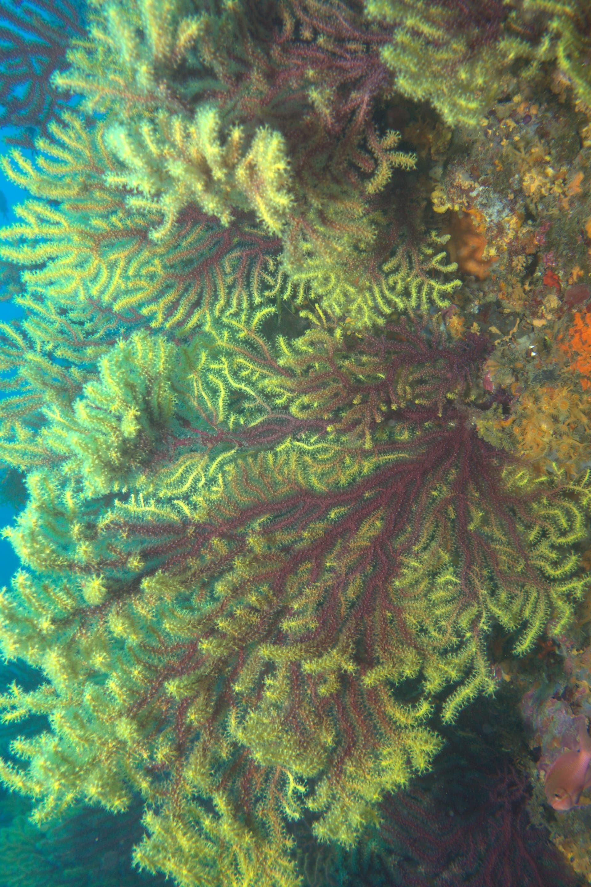
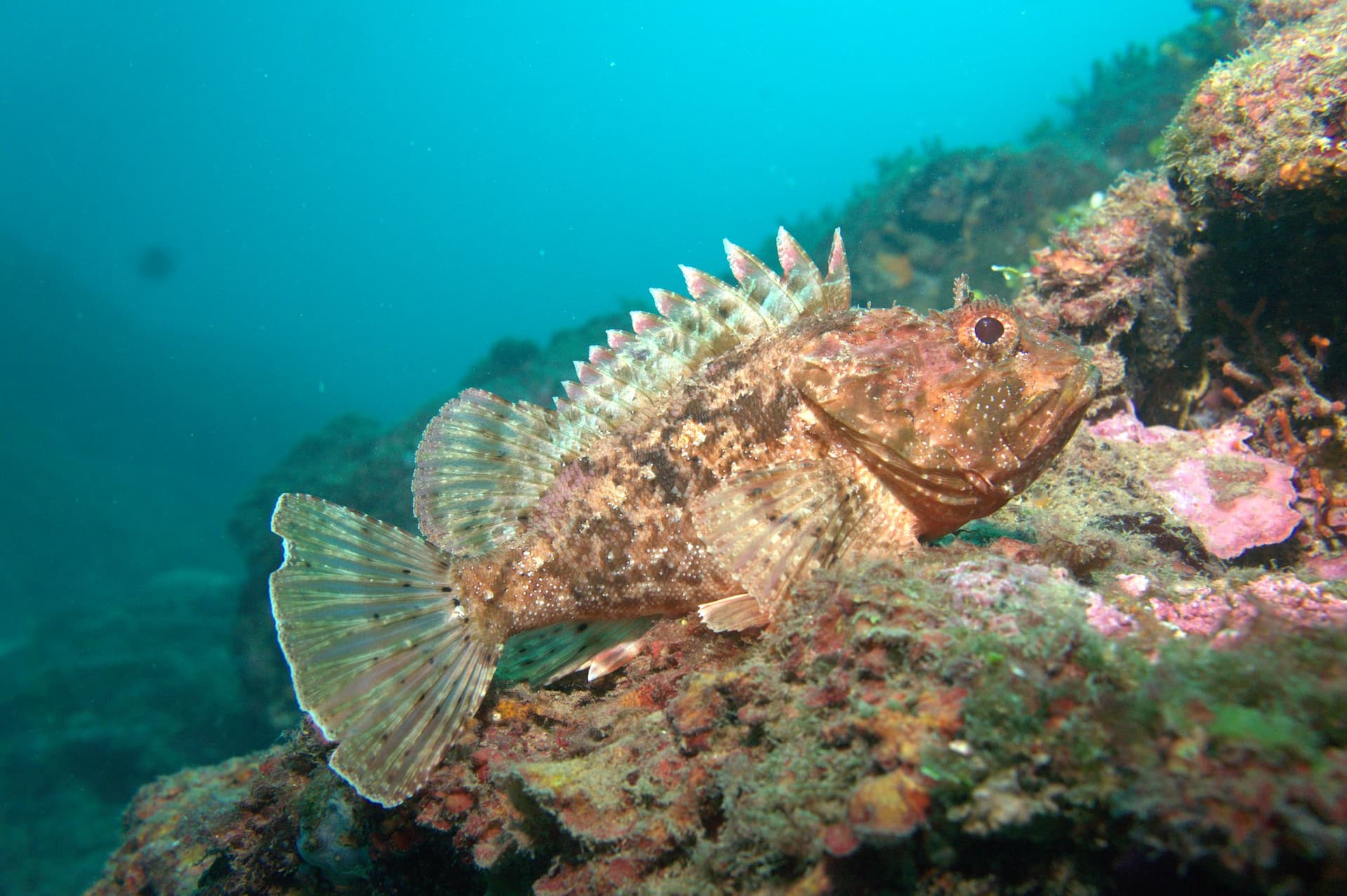
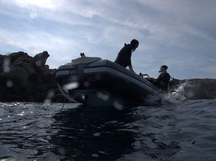
Three experiences define diving at Begur. Furió Fitó rises a kilometre off the headland from a 50-metre-plus floor to a 14-metre plateau, with a secondary pinnacle at 26; local sources call it the area's signature advanced dive and limit it to experienced divers because of the depth and the current it can carry. Cap de Begur drops from the most protruding headland on this coast into three parallel rocky bars, the deepest reaching around 37 metres under red and yellow gorgonians. The third experience is shallower and stranger: a shore dive from Aiguablava cove passes Roman amphorae on the seabed, and the local centres run archaeological baptism dives that combine a first descent with the wreck site. Around those anchors, the area holds Illa Negra, a dark-rock island honeycombed with crevices where lobsters, conger eels, and morays share tight quarters; Canons de Tamariu, four parallel rocky-ridge formations in more sheltered water; and Sa Tuna, whose cave hides a car-sized boulder riddled with holes, each one occupied by a lobster. Cala Aiguafreda, whose name means "cold water," allows long shallow dives; one Barcelona club logged 88 minutes there in November. The texture of the diving is small-scale. One slipway at Aiguablava, two operational centres, most sites under ten minutes by boat. Divers arrive by car, change on the sand, and board within a couple of hundred metres of their kit.
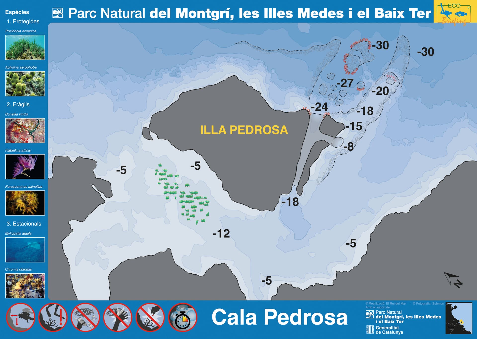
Begur occupies the middle of the Costa Brava coast, with Illes Medes eight kilometres north and Calella de Palafrugell twenty south, which makes it a practical base for the central coast rather than a destination on its own. Begur Dive runs out-of-area trips to Medes, Els Ullastres, and Illes Formigues for weeks that want variety beyond the local twelve-site rotation. No permits are required for the diveable sites. The Reserva Marina de Ses Negres runs along the same coast between Cap Negre and Pa de Pessic, an 80-hectare zone established in 1993; recreational scuba inside the reserve is prohibited, and only a small programme of guided educational visits through authorised centres has operated there since 2016. Sa Tuna cove has a historical June-September restriction that is worth re-verifying with the centre before a summer shore dive. Most boat days are calm, but Cap de Begur and Furió Fitó are weather-dependent and operators redirect to sheltered sites when the headland is exposed. The nearest hyperbaric chamber is in Palamós.
Granite basement of the Catalan Coastal Range. Marine erosion along joint planes has produced vertical walls at Cap de Begur, isolated pinnacles (furiós) offshore, and parallel canyon systems (canons) south toward Tamariu. The headland protrudes furthest into the Mediterranean on this stretch, which is why its three descending rocky bars catch more current than the coves either side. Sheltered inlets between granite outcrops collect sand and Posidonia.
The must-do dives in this area, picked by our editors.
AOW divers seeking a multilevel drift dive with gorgonian walls and crevice fauna on an exposed Mediterranean headland
Advanced divers wanting an open-sea Costa Brava wall dive with dense Paramuricea cover and a deep profile within one boat-mooring
Open Water divers wanting a sheltered multilevel island circuit with gorgonians, crevice fauna, and a standout detached rock formation near Begur.
Diamonds mark nearby dive areas — tap to explore.
Parallel rocky ridges form gorgonian-walled canyon throats between Aiguablava and Aigua Xelida, 9-40m, with barracuda schools and grouper.
A coffee bean-shaped rock at the mouth of Tamariu port, 9-24m, sheltered from the tramuntana and packed with conger and moray eels.
Secluded pebble cove between Tamariu and Llafranc, foot-access only via GR92. Shallow granite reef to 10m, best for snorkeling. Exceptional water clarity.
Submerged massif north of Cap de Begur with a 12 m plateau, near-vertical gorgonian north wall to past 50 m, and a smaller adjacent pinnacle.
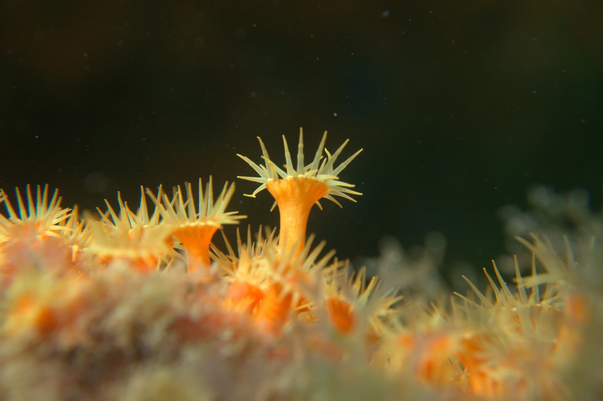
Sheltered Costa Brava cove near Begur with shore entry, three small chimneys, and a quiet macro-photography reputation at 12-18m.
Submerged rock with a summit islet near Cala Aigua Xelida, offering canyons, a swim-through arch, a cavern at 12m, and gorgonian walls from 0 to 35m.
Sheltered island wall south of Cap de Begur with white gorgonians, yellow anemone overhangs, and a detached 'second island' rock at 13-21m.
Three parallel rocky ridges at 5-38m off Costa Brava's most exposed headland, with red gorgonian forests on the deepest wall at 37m.
Book online or contact a centre that dives this area.
Family-owned dive center in Llafranc since 1979, with 4.9/5 on 717 Google reviews, covering 11 sites across two Costa Brava dive areas.
SSI dive centre on Aiguablava beach in Begur, Costa Brava, running boat and shore dives to a dozen sites within ten minutes of the launch.
Family-run SSI and PADI center in Tamariu since 1971, with a seahorse-rich house reef, 13 dive sites by boat, and children's programs from age 8.
Family-run SSI center on Menuda Beach in Tossa de Mar since 1998, with eco-guide philosophy, 17 dive sites, and authorized Cressi service.
PADI, SSI, and CMAS center at Port Marina Palamós with year-round boat dives, small groups, and full MARES equipment. SSI Instructor Training Center.
Small SSI center on the Cala Gogo beachfront near Sant Antoni de Calonge, capping discover dives at two and courses at four, with the boat from Palamos.
Small PADI centre embedded in Camping Sant Miquel at the top of the Costa Brava, working a Tramontana-sheltered coast from Colera into the Cerbere-Banyuls reserve.
Get in touch to add or claim your dive center listing on DiveCodex.
Log your dives - notes, photos, conditions and the marine life you saw - and share them as one public diver profile. What you share helps the next diver, too.
Log every detail
Depth, duration, conditions, gear, buddy, notes — all in one place. Import from Suunto and other dive computers.
Track marine life
Record species sightings on each dive. Build a personal catalogue of everything you've seen underwater.
Your public dive profile
Share your dive history, stats, and experiences with a profile page you control. Show the world where you've been.