
Cap de Creus Dive
PADI 5-Star center in El Port de la Selva with brand-new Aqualung gear, max 4 divers per guide, and year-round boat diving in Cap de Creus Natural Park.
PADI4 languages
Spain's easternmost peninsula: Paleozoic schist and pegmatite walls, caves, and the pinnacle of Massa d'Or inside Catalonia's first marine natural park.
Last updated April 2026
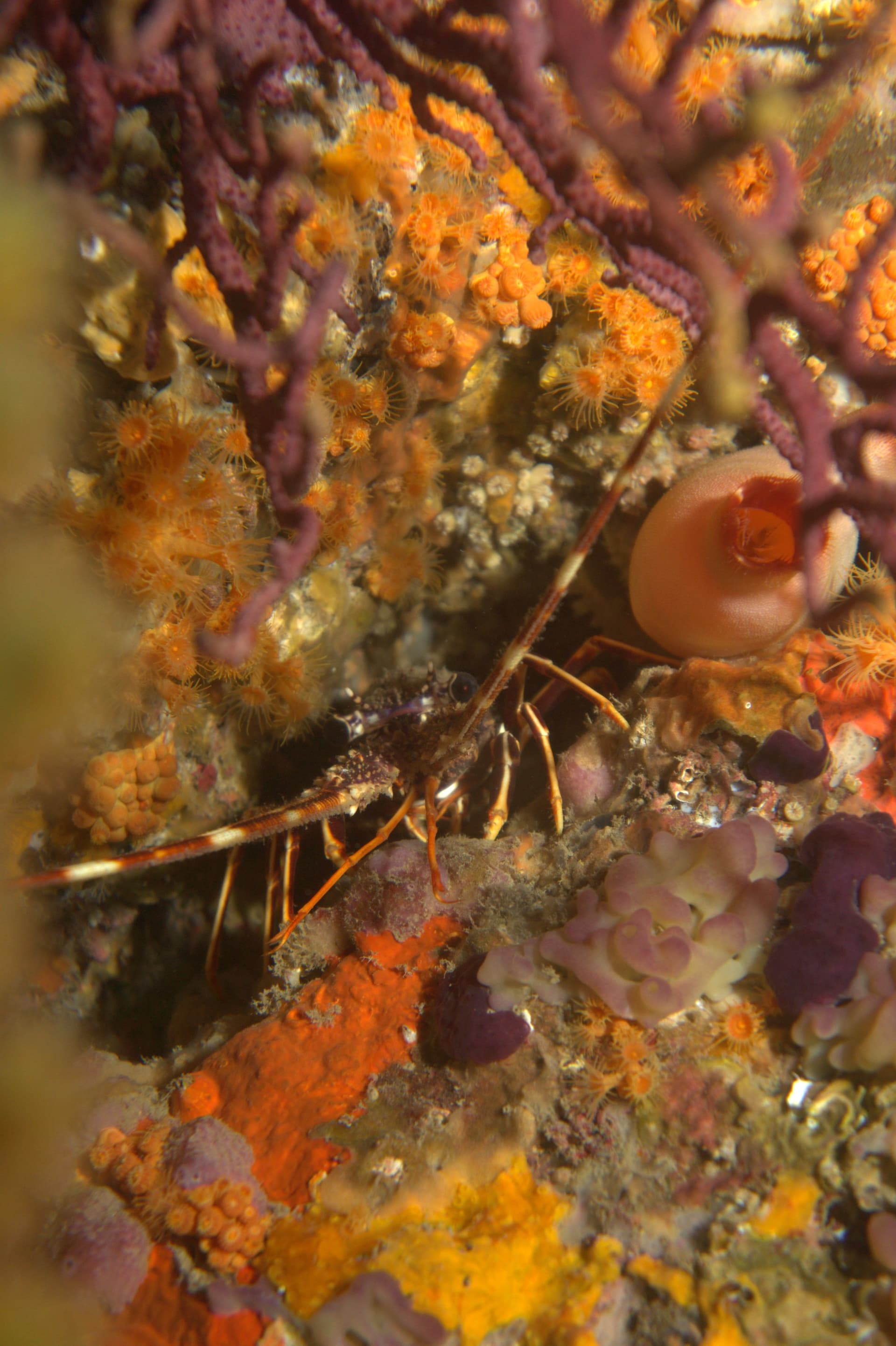
Cap de Creus occupies the northern third of the Costa Brava, from Roses north through Cadaqués and Port de la Selva to Llançà. The peninsula is the easternmost point of the Iberian Peninsula, where the Pyrenees axial zone meets the Mediterranean. Its rock is Paleozoic schist cut by resistant pegmatite dikes, and differential erosion between the two carves the landscape divers come to see: plunging walls, isolated pinnacles, caves, and swim-throughs, with tafoni honeycomb weathering on exposed surfaces. Black tourmaline crystals up to a metre long sit in the pegmatite for anyone who looks closely.
Massa d'Or is the flagship. The offshore pinnacle rises from around 55 m to 10 m and draws grouper aggregations, barracuda schools, amberjack, and occasional tuna. It is an advanced, current-exposed site, and many divers plan the whole trip around it. The Cap Norfeu sector off Roses delivers the everyday diving at stacked depth zones, with El Gat as the most-dived site and Punta Falconera, El Bau del Cap Trencat, and El Salt del Boc close behind. The northern park holds the 1884 Woodside wreck plus the El Molar reef; Cala Culip sits inside Els Farallons Partial Reserve. The park became Catalonia's first maritime-terrestrial natural park in 1998, and the 2025 PRUG has since capped operator numbers and mandated boat tracking.
Girona-Costa Brava airport is around 65 km from Cadaqués (roughly 70 minutes on narrow mountain road). Barcelona is 170 km. No coastal road links Cadaqués to Port de la Selva; you go inland via Vilajuïga. Pick your base by the sector you want to dive: Cadaqués for Massa d'Or and the central coast, Roses for Cap Norfeu, Port de la Selva or Llançà for the northern park.
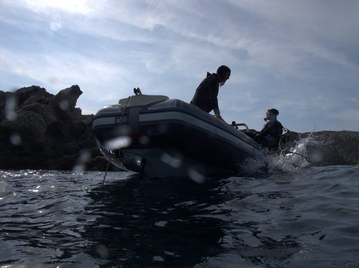
The Tramontana is the planning variable. It can shut outer sites for days and it also carved the above-water rock sculptures you pass on the drive in. Operators read the forecast and substitute sites at short notice, so keep itineraries flexible rather than fixed. Plan exposure suit for the cold side of the thermocline at 15 m, not the surface reading, even in August. Independent divers must pre-notify park management and respect personal caps (6 daily, 30 weekly, 120 annually) under the 2025 PRUG. Night diving is allowed at shore sites but prohibited inside Partial Nature Reserves without special authorisation. Carry ID, certification, logbook, and medical clearance under two years old.
Easternmost extension of the Pyrenees axial zone. Variscan metamorphic schist with pegmatite dikes and veins (black tourmaline crystals to a metre, blue K-feldspar), gneiss and granitic intrusions. Differential erosion between resistant pegmatite and softer schist produces walls, pinnacles, caves, swim-throughs, and tafoni weathering both above and below water.
The must-do dives in this area, picked by our editors.
Cap de Creus's flagship grouper-and-barracuda pinnacle for advanced divers
Certified divers comfortable with currents who want a representative gorgonian wall in the southern Cap de Creus sector
Certified divers comfortable with current who want a representative open-water Cap de Creus dive between the gorgonian wall and pelagic blue
Divers who want the geology and protection of Cap de Creus from a quieter working-village base, accepting more weather-dependent days
Diamonds mark nearby dive areas — tap to explore.
Sheltered Cap de Creus cove below the lighthouse, layering Roman and medieval shipwreck excavation sites over Posidonia meadows and a shallow rocky ridge.
Shallow swim-through cavern beneath the Cap de Creus lighthouse with a natural roof opening that lights the chamber from above.
Cat-eared rock at Cap Norfeu where white gorgonians give way to red on a single multi-level wall, with strong currents and a north-face alternative.
Open-water island half a mile east of Port Lligat with a south-side canyon, gorgonian walls and pelagic fish — currents can change mid-dive.
Submerged pinnacle off the Cap de Creus lighthouse: dusky grouper aggregations, large barracuda schools and red gorgonian gardens, with serious current.
Northern access point for Cap de Creus Natural Park, with boat dives to 20+ Paleozoic walls, caves, gorgonian gardens, and the 1884 Woodside wreck.
French cargo steamer sunk by a naval mine on 8 March 1939 in the Bay of Roses -- a war grave at 50-60 m, technically demanding, with 27 crew lost.
Book online or contact a centre that dives this area.
PADI 5-Star center in El Port de la Selva with brand-new Aqualung gear, max 4 divers per guide, and year-round boat diving in Cap de Creus Natural Park.
Small PADI centre embedded in Camping Sant Miquel at the top of the Costa Brava, working a Tramontana-sheltered coast from Colera into the Cerbere-Banyuls reserve.
SSI Instructor Training Center in Cadaques since 1996, guided dives to 25+ sites in Cap de Creus Natural Park plus a blue shark snorkeling program.
Get in touch to add or claim your dive center listing on DiveCodex.
Log your dives - notes, photos, conditions and the marine life you saw - and share them as one public diver profile. What you share helps the next diver, too.
Log every detail
Depth, duration, conditions, gear, buddy, notes — all in one place. Import from Suunto and other dive computers.
Track marine life
Record species sightings on each dive. Build a personal catalogue of everything you've seen underwater.
Your public dive profile
Share your dive history, stats, and experiences with a profile page you control. Show the world where you've been.